
Gergely Baics, Barnard College, Columbia University
 Geographic information system (GIS) has changed social science and humanities research through spatial analysis. It has reinvigorated the spatial turn, which has swept many fields in the past decades, improving their empirical foundations, methodological tools and analytical process. Historians, especially those working within the field of urban history, have looked to GIS to incorporate new resources and methods to raise new questions or revisit old ones. Further, given the considerable data demands of certain projects, GIS mapping has made historical research more accessible, collaborative and open-ended. Some of the most fruitful collaborations occur when the public is directly invited to help produce and make use of historical GIS data, as is the case with the New York Public Library’s several creative initiatives (Map Warper, Building Inspector, NYC Space/Time Directory), or when historians work together with geospatial analysts to produce innovative scholarship in interdisciplinary centers, such as the Spatial History Project at Stanford University.
 At the first step, GIS mapping tends to be a reconstructive process for urban historians. It involves unearthing and recreating past urban landscapes whether looking at the historical city entirely or exploring a specific subject. Often source challenges abound, which include finding and geo-referencing historical maps, locating places of import from those and other sources, digitizing geographic features using GIS software, and creating and linking relevant data to those features. Much of the process can be tedious and time consuming, and therefore it is of enormous value that historical repositories and research centers have recently taken the lead to generate and make available essential GIS data. My initial approach in studying the food markets of New York City in the first half of the long nineteenth century fell squarely into this reconstructive process. The New York Public Library’s New York City Historical GIS Project has been invaluable in providing relevant GIS resources. The process of historical reconstruction is gradual, open-ended and by definition always unfinished. It results in cartographic representations of the historical city, preparing the ground for spatial analysis.
 While historical reconstruction is valuable in and of itself, it is only the first step of spatial analysis. The real power of GIS mapping is to explore spatial relationships. Mapping as process differs from mapping as representation in that it is generative of new questions and answers, feeding back into a productive cycle of research and interpretation. Whether the process involves overlaying distinct features of the urban environment, deploying different spatial datasets, or making use of the many statistical and other tools embedded in the software, GIS presents a versatile framework to study urban history through spatially oriented questions. The possibilities are endless and therefore can be overwhelming. The point is to keep the historical problem in focus yet open-ended, and employ the appropriate resources and tools. Mapping the locations and sizes of food markets in nineteenth-century New York City is already informative; overlaying them with demographic data goes further in exploring supply and demand relations in urban household provisioning; while situating the food system within the city’s broader commercial geography, built and social environments create additional layers of interpretive context. At each step, new questions emerge, moving the mapping process forward from reconstruction toward analysis. In the case of my forthcoming book, Feeding Gotham: The Political Economy and Geography of Food, 1790–1860 (Princeton University Press, 2016) the research agenda has gradually shifted from mapping food markets to mapping food access in the nineteenth-century American city.
It should take little convincing of urbanists that the problem of food access is a consequential matter. This seems self-evident as concerns over food justice have occupied a more prominent place in our current debates about urban social inequalities. In particular, the problem of food deserts, that is, areas without convenient access to healthy and affordable food supplies, contributing to a variety of diet-related health conditions, has gained popular attention. Tellingly, a food desert is a geographic concept. As a spatial metaphor, it conveys the urgency to incorporate food into our general framework of socio-spatial inequalities in access to basic goods and services in the urban environment. And while food deserts might sound anachronistic in the context of nineteenth-century cities, the underlying idea of spatial injustice in the distribution of vital resources such as daily food supplies, affecting residents’ basic health and living standards, can be studied with GIS mapping not only for contemporary but also for historic cities.
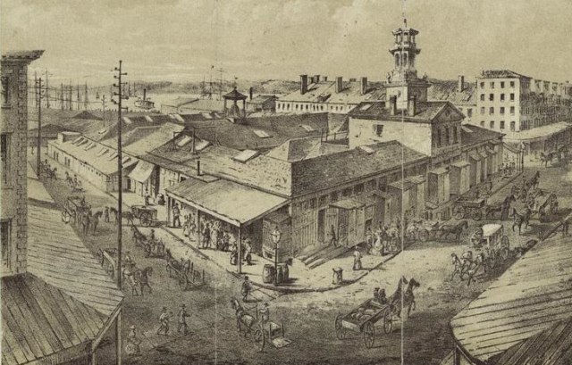
Washington Market, 1850s
To be sure, urban historians have increasingly discovered the importance of food systems in cities, looking at supply chains and infrastructures, dietary changes and cultural practices. Still there remains much to be done to incorporate food access into our overall assessment of past urban living conditions. My book takes as its starting point that food should be treated as one of three most basic necessities in the nineteenth-century city, together with the much better studied conditions of housing and sanitation. Spatial analysis opens up this understudied domain to empirical investigation. Pressing questions include, for example, how government policy shaped the development and functioning of modern provisioning systems; how food infrastructures from wholesale to retail distribution responded to urban growth, and served residents’ basic needs to adequate quantities and quality of supplies; or what role changing conditions of food access played in the material well-being and social inequalities of increasingly diverse populations. These are well-established themes when describing the history of housing or sanitation: for example, how tenement reform or municipal waterworks affected living standards and public health. In the case of food, we are still on more uncertain ground. Mapping food access as a matter of city governance, built environment, infrastructure, and living standards provides a framework and methodology to advance research in this vital domain of the modern urban experience.

Aerial View of New York City, 1850s
In examining how food access developed in New York during the first half of the long nineteenth century, when the city’s population increased from thirty thousand to nearly a million, my book offers insights with relevance beyond my case study. Its narrative traces how access to food, once a public good, became a private matter left to free and unregulated markets, and how this affected the city’s development and the living standards of residents. At the beginning of the nineteenth century, New York was provisioned through a public market system, tightly managed and regulated by the municipal government. Under the pressures of accelerating urbanization and a shift toward free-market ideology, food markets were deregulated in the 1840s, pushing food access from the public to the private domain. Correspondingly, the geography and infrastructure of the food system changed dramatically. Daily access gradually shifted away from closely regulated public markets to thousands of unregulated shops, sprawling across the urban landscape. A free-market system of provisioning, however, not only opened up previously closed food trades, and brought food retailers closer to customers. It resulted in the city’s surrender of oversight of its food supplies, with negative consequences to quality. Further, it contributed to rising inequalities, as differential access to daily provisions mapped onto other essential socio‑spatial disparities, in particular housing and sanitation, in mid-century New York’s increasingly segregated residential environment.
Studying spatial relations demands an understanding of the political economy of their production, as we know from critical geographers. GIS mapping has provided empirical base and analytical process to uncover how distinctive regulatory frameworks produced different geographies of food access, and how a highly uneven food landscape emerged by the mid-nineteenth century to become a defining and enduring feature of the American city.
Gergely Baics is assistant professor of History and Urban Studies at Barnard College, Columbia University. His research interests include urban social and economic history, New York City history, social science history methods, and historical GIS. His book, Feeding Gotham: The Political Economy and Geography of Food, 1790-1860 is forthcoming with Princeton University Press (2016).

Reblogged this on Kang, Ashley and commented:
“Mapping as process differs from mapping as representation in that it is generative of new questions and answers, feeding back into a productive cycle of research and interpretation.”
LikeLike