By Irene Vlad, Freie Universität Berlin
Hebron (al-Khalīl in Arabic) is the oldest, largest, and most populated city in the West Bank. It is widely known as one of the main hotspots of Israel’s ongoing conflict with the Palestinians. Often mentioned in the newspapers, the city’s troubled history encapsulates both the complexity of the Israeli-Palestinian conflict and the divisions that it has caused. In Hebron, more than anywhere else in the West Bank, the divide between a Jewish colonizing minority and a Palestinian majority has been carved into urban space – consistent political and military intervention having transformed the city’s architectural structure. Urban segregation, strictly marshaled by the Israeli army, has ensured the manipulation of the city’s landscape, successfully conforming it to the needs of surveillance and control.

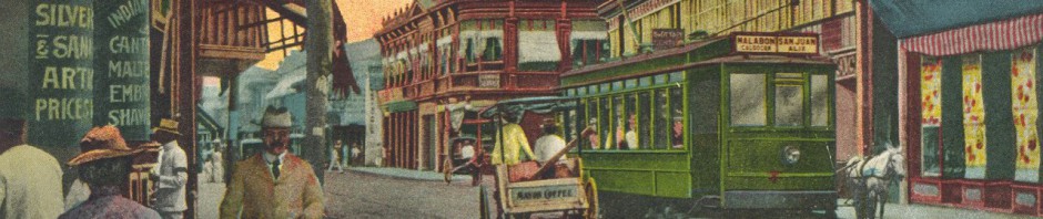
Hebron in the 1890s
Hebron’s militarized segregation has often been depicted as a wholly unique situation. Dalsheim and Harel, for instance, co-authors of Representing Settlers, argue that religious settlements in the West Bank are widely viewed as exceptional, unprecedented cases of urban violence and segregation. In the debate within Israeli public opinion and scholarship – of which Dalsheim and Harel form a part – religious settlers have often been depicted as mere fundamentalists, and thus irrational, subjects. Settlers in Hebron have indeed sought to justify their actions by citing the belief that the city is Jewish by divine right and therefore the restoration of the Jewish community of Hebron is imperative.
The pervasiveness of this exceptionality narrative has obscured the analogies Hebron shares with many cities. The city’s transformation towards an ethnically segregated and militarized space, where “securization” practices play a major role has actually striking parallels with the urban policies implemented in several colonized cities of the nineteenth and twentieth centuries. While neither ethnic segregation nor militarization are specific to colonial cities – for instance, the Haussmanization of Paris can also be considered as a militarization of urban space – the combination of the two processes is so indeed. This combination is in fact quite typical of cities which underwent colonization by European powers in the nineteenth and twentieth centuries. Acknowledging this allows us to place Hebron’s transformation of the last decades in a broader historical context.

Checkpoint in Hebron’s Old City, 2007
Carl Nightingale’s Segregation: A Global History of Divided Cities traces the transnational history of segregation from ancient to contemporary times. Though acknowledging the presence of urban segregation even “before race mattered” the author suggests that it was colonialism that first fostered institutional and particularized segregation practices, typically carried out through militarization. Analyzing multiple cities in various geographical areas and in different periods, Nightingale shows how city splitting and the military crafting of space were recurring features in several colonial cities. Towns were often not only divided along racial lines, but also physically altered by armies in order to guarantee the security and the power of the ruling minority. Nightingale’s account of urban development in India after the Great Indian Revolt of 1857 in particular is exemplary: besides the creation of enclaves for white settlers, several Indian cities were refashioned by the British army through the establishment of military bases within the city and the construction of vast esplanades, both designed to prevent further uprisings. During the revolt, the city of Lucknow experienced days of brutal warfare and the destruction of many buildings. In the rebuilding process, British engineer Robert Napier designed Haussmann-style, straight, diagonal avenues enabling the easy transition of troops throughout the city, while also boosting the efficiency of anti-guerrilla operations. Nightingale’s description of French colonial enterprises also shows similarities in the management of urban landscape for security reasons: in the 1830s and 1840s, Algiers’ military reconstruction after years of warfare against rebel Emir Abd el-Kàder entailed the creation of an ethnically segregated city, largely designed for the needs of the French military and their operations. The urban landscape was thus subverted in order to guarantee appropriate surveillance measures, which progressively led to the transformation of the city’s original landscape.
These examples show how segregation and militarization were part of urban planning in both the British and the French empires. With a view to defending the small minority of British and French settlers from uprisings and rebellions, the architecture of these colonial cities was thus reorganized according to the imperatives of separating and securing. Sophisticated technologies of control increasingly became part of the urban landscape, superimposed onto the original cityscapes. Planning principles, such as the creation of buffer and no-go zones, internal frontiers and fences were often conceptualized by the militaries themselves, taking the place of urban planners and designers. Through studying and mapping these cities’ complex fabrics, the colonial powers were able to gain better control over the respective populaces. Indigenous and “hostile” colonial cities were reconfigured according to military maps, where fences, segregated neighborhoods and borders were utilized to shape a smooth and manageable urban geography.

Kiryat Arba, a Jewish settlement on the eastern outskirts of Hebron, 1970s
This process of simultaneous segregation and militarization, aimed at containing possible insurgencies, also reflects the history of Hebron after 1967. Since then, the city has been a theatre of incessant urban warfare; warfare that has permeated its alleyways, the walls of its houses and the staircases of the Old City’s buildings. The Six-Day War in 1967 and Israel’s military victory over the Arab states led to a refashioning of the entire regional landscape, facilitated through Israel’s occupation of the West Bank. The decision to seize space both within and near Hebron stemmed from the city’s preeminent place in Judaism’s history – Abraham’s Tomb being located in the middle of the Old City. The first Israeli settlers arrived during Pesach 1968 when a group of civilians, guided by Rabbi Moshe Levinger, rented Hebron’s Park Hotel and refused to leave the area after the end of Passover. Despite initial obstruction from the Israeli government, this small group, resolute in its aim to restore Hebron’s old Jewish community, managed to establish the first settlement at the outskirts of the city, Kiryat Arba, followed by the first one within Hebron’s Old Town, Beit Hadassah.
The support the Israeli government eventually lent to these urban settlements led to the seizure of a Palestinian bus station and school by the Israeli military, later to be transformed into a military base and a school for Jewish religious studies. Similar to Beit Hadassah, the Avraham Avinu settlement is located in the heart of the Old City and was established through the demolition of Palestinian buildings and the military restructuring of the area. Palestinians have resisted this occupation of urban space, engaging in persistent low-intensity guerrilla warfare with Jewish settlers. Thus, the need to both safeguard the settlers and allow unencumbered military operations to facilitate their protection has prompted a profound militarization of the urban fabric and the imposition of a war-like landscape. Buffer zones, fences and closed roads have thus been established in Hebron’s city center and have subverted its historical foundations: the original function of most of the buildings in the Old City has been diverted to fulfill the needs of the military. Schools becoming military bases and former markets transformed into buffer zones are just some examples of this architectural process.

2011 Map of Hebron, showing settlements, areas “closed to travel,” and closed roads.
Moreover, owing to persistent attacks from both sides, the 1997 Hebron Agreement imposed the concrete division of the city into two distinct areas, H1 and H2, administered by the Palestinian Authority and the Israeli army respectively. H2 represents 20 percent of Hebron’s city, and is inhabited by roughly 700 settlers and 30,000 Palestinians. The complex geometries of H2, the checkpoints, and the huge deployment of soldiers “protecting” the settlers from Palestinian inhabitants have enabled the 700 settlers to exercise a disproportionate influence upon the Palestinian majority inhabiting the area. The regular curfews and the radical restriction of movement imposed upon the Palestinian inhabitants have transformed H2 into a desolated military landscape. The belief that the conquered areas have to be defended from Palestinian insurgencies has thus dramatically supplanted the Old City’s geography with a complex network of no-go zones, newly erected walls and military checkpoints that combine to represent a deeply security-driven perception of space.
The convergence of militarization and segregation put in place to accommodate the security needs of a small minority in Hebron recalls the urban policies implemented by the French and British colonial armies in Algiers and Lucknow. I suggest, therefore, that Hebron’s history and its well-targeted spatial manipulation might be evaluated via a different perspective: not merely as an expression of religious fundamentalism and exceptionality, but rather as part of a global trend that has commonalities with the European colonial enterprises of the nineteenth and twentieth centuries. In contemporary Hebron, as in many colonial cities of the past, militarization and segregation seem to merge in order to ensure both the (un)making of urban space according to the necessities of military surveillance and the inscription of ethnic and racial hierarchies in the urban fabric.
Irene Vlad studies Global History at the Freie Universität Berlin. Her main research interests are in the history of migration and of the Middle East.
